


available on the
Google Play
Planning to buy land in Kenya? Think about the daily commute. Learn how matatu routes, highways, and public transport access affect land value and rental demand.
You have found a beautiful plot. It is quiet. It is peaceful. The price is right.
But can you reach it every day? Can your tenants reach town for work?
In Kenya, public transport access is not just a convenience. It is a major factor that determines:
How much your land is worth
How fast it sells
How much rent you can charge
Whether tenants will stay
At Nyota Njema Real Estate, we have seen plots in the same area sell for very different prices. The difference? One is near a matatu stage. The other is not.
This guide explains why transport access matters and which satellite towns offer the best connections.
Land near matatu routes and highways appreciates faster.
Tenants prioritize easy commuting over spacious homes.
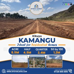
Satellite towns like Kitengela, Ruiru, and Juja thrive because of transport links.
Diaspora buyers often overlook commute times. This hurts rental income.
Always check travel time to Nairobi CBD during peak hours.
Future infrastructure plans (roads, railways) can boost land value.
Nyota Njema helps you verify transport access before you buy.
Over 70% of Nairobi workers live outside the city center. They commute daily. Some travel two hours each way.
For these workers, the daily commute is the most important factor in choosing where to live. They will pay more rent to live near reliable transport.
If your land is in a beautiful area but requires a 3km walk to the nearest matatu stage, tenants will leave. They will choose a smaller house closer to the road.
When you sell your land, buyers will ask: “How far to the main road? How long to town?” Good answers mean higher prices.
Land near transport hubs can host shops, kiosks, and businesses. This adds income streams beyond residential rent.

This is Kenya’s busiest road. It connects Nairobi to the coast. Land along this highway is always in demand.
Satellite towns on this route:
Syokimau: Near Jomo Kenyatta International Airport and SGR terminus.
Mlolongo: Major truck stop, growing residential area.
Kitengela: Off the highway but connected via a short link road.
Athi River: Industrial zone with growing housing demand.
Thika Road transformed northern Nairobi. It made satellite towns accessible.
Satellite towns on this route:
Ruiru: Directly on Thika Road. Excellent matatu and bus services.
Juja: Further along Thika Road. Student population drives demand.
Kahawa: Near Kenyatta University.
Githurai: High-density, high-demand rental area.
The area along Mombasa Road from Nairobi to Kitengela is booming.
Key areas:
Imara Daima: Near SGR and Southern Bypass.
Kitengela: 30-45 minutes from Nairobi via Mombasa Road.
Isinya: Further out, but with new developments.
These roads opened up previously inaccessible land.
Affected areas:
Kamulu: Accessible via Eastern Bypass.
Ruiru East: Served by Eastern Bypass.
Githunguri: Northern Bypass access.
Wangige: Growing due to bypass connectivity.
Upgraded road has made this corridor attractive.
Towns:
Kinanie: Next growth frontier.
Kamulu: Continuing development.
Tala: Further out, affordable land.
Towns:
Ngong: Scenic, growing fast.
Kiserian: Further out, affordable.
Limuru: Cool climate, good road access.

Here is a detailed look at major satellite towns and their public transport access.
| Town | Main Route | Distance to CBD | Commute Time (Peak) | Matatu Routes | Notes |
|---|---|---|---|---|---|
| Kitengela | Mombasa Road via Athi River | 30 km | 45-75 mins | 125, 126, 127 | Multiple Saccos. Direct matatus to CBD. |
| Ruiru | Thika Road | 25 km | 30-60 mins | 105, 106, 107, 108 | Excellent frequency. 24-hour services. |
| Juja | Thika Road | 35 km | 45-90 mins | 105, 106 | Student-focused routes. Less frequent at night. |
| Syokimau | Mombasa Road | 20 km | 30-50 mins | 34, 125 | Near airport and SGR. Premium route. |
| Ngong | Ngong Road | 24 km | 45-75 mins | 111, 126, 24 | Scenic but congested. |
| Kamulu | Kangundo Road / Eastern Bypass | 30 km | 50-90 mins | 114, 115 | Improving but still developing. |
| Kinanie | Kangundo Road | 35 km | 60-100 mins | 114, 115 | Emerging area. Road upgrades coming. |
| Mlolongo | Mombasa Road | 18 km | 25-45 mins | 125, 126, 34 | Prime location. Heavy traffic. |
| Athi River | Mombasa Road | 25 km | 40-70 mins | 125, 126 | Industrial. Growing residential. |
| Kahawa | Thika Road | 20 km | 25-50 mins | 114, 115, 34 | Student rental hotspot. |
| Githurai | Thika Road | 15 km | 20-45 mins | 114, 115, 34 | High density. Always in demand. |
| Limuru | Naivasha Road | 40 km | 60-90 mins | 104, 114 | Cool climate. Growing slowly. |
| Kiserian | Magadi Road | 35 km | 60-90 mins | 126, 127 | Affordable. Limited night transport. |
Note: Commute times vary based on traffic, weather, and time of day. Always test the route yourself.
Nairobi’s matatu system is complex. Here are the key routes serving satellite towns.
| Route Number | Destination | Major Saccos |
|---|---|---|
| 125 | Kitengela / Athi River | Southfield, Transit, KBS |
| 126 | Kitengela / Isinya | Southfield, Daystar |
| 127 | Kitengela / Kiserian | Southfield, Mash |
| 105 | Ruiru / Thika | Citi Hoppa, Mwiki |
| 106 | Ruiru / Kenyatta University | Citi Hoppa, Kenblest |
| 107 | Juja / Thika | Citi Hoppa, Kenblest |
| 108 | Ruiru / Githurai | Double M, Mwiki |
| 114 | Kamulu / Kangundo Road | KBS, Mbus |
| 115 | Kamulu / Koma Rock | KBS, Mbus |
| 34 | Syokimau / Imara Daima | KBS, Mombasa Raha |
| 111 | Ngong / Kibera | Ngong Road Saccos |
| 24 | Ngong / CBD | Ngong Road Saccos |
| 104 | Limuru / Nairobi | Limuru Saccos |
Frequency: Do matatus run every 5 minutes or every 30?
Night service: Are there matatus after 10pm?
Terminus: Where do they drop passengers in town?
Reliability: Do they go on strike often?
Cost: Is the fare affordable for typical tenants?

If you live abroad, it is easy to ignore transport. You see a beautiful plot. You imagine a quiet weekend home.
But if you plan to:
Rent the property to tenants
Sell it later for profit
Live there when you return
…then transport access matters.
“How far is the nearest matatu stage from this plot?”
“How long does it take to reach Nairobi CBD during morning rush hour?”
“Are there matatus at night for tenants who work late?”
“Is the access road tarmac or murram? Will matatus use it in rainy season?”
“Are there plans for new roads or bypasses near this area?”
We drive the route during peak hours and record it.
We show you the matatu stage and frequency.
We interview locals about transport reliability.
We upload videos to the Nyota App so you see the commute.

| Transport Access | Rental Demand | Typical Rent (2-bedroom) | Vacancy Rate |
|---|---|---|---|
| Excellent (near stage, tarmac road) | High | Ksh 15,000 – 25,000 | Low (under 5%) |
| Good (short walk, murram road) | Medium | Ksh 10,000 – 18,000 | Moderate (5-15%) |
| Poor (long walk, bad road) | Low | Ksh 8,000 – 12,000 | High (15-30%) |
| Very Poor (no matatu access) | Very Low | Hard to rent | Very High |
Example:
Two identical houses in Ruiru. One is 200 meters from a matatu stage on a tarmac road. The other is 1 km down a muddy track. The first rents for Ksh 18,000. The second struggles to find tenants at Ksh 12,000.
Smart investors buy before infrastructure is built. Here are projects to watch.
Already transformed access to Westlands and JKIA. Areas near exits gained value.
Will improve connectivity around CBD. Benefits satellite towns with train access.
Plans to expand train services to:
Syokimau (already has SGR terminus)
Ruiru (potential commuter station)
Juja (potential)
Kitengela (long-term dream)
Will improve access to Eastlands and connect to bypasses.
Not Nairobi, but affects coastal land values.
Will improve access to areas north of Thika.
Will open up land south of Kitengela.
Your plot may be near a highway but 3 km down a muddy track. That last mile kills value.
Solution: Check the entire route, not just the main road.
Some routes are unreliable. Saccos fight. Routes change.
Solution: Ask locals. Don’t rely on one opinion.
Some roads become impassable in rain.
Solution: Visit during rainy season or send Nyotanjema.
Some roads have high accident rates. Tenants avoid them.
Solution: Check accident history with locals.
If your tenants work late shifts, they need night matatus.
Solution: Check if matatus run after 10pm.
Ruiru: Thika Road, multiple routes, 24-hour matatus
Syokimau: Mombasa Road, SGR, airport
Kitengela: Frequent matatus, improving roads
Kahawa: Thika Road, near Kenyatta University
Juja: Thika Road, student-focused
Ngong: Ngong Road, frequent but congested
Mlolongo: Mombasa Road, heavy traffic
Githurai: Thika Road, high density
Kamulu: Kangundo Road upgrades coming
Kinanie: Future growth area
Kiserian: Affordable but limited night transport
Use Google Maps during peak hours (7am-9am, 5pm-7pm). See traffic colors. Red means bad.
Drive the route yourself. Experience the commute.
Walk to the nearest stage. Count how many matatus pass in 10 minutes.
Ask locals: “How is the transport here? Do you struggle?”
Visit after 10pm. Are matatus still running?
Check with county government. Any road upgrades planned?
We do all this for diaspora buyers. We send videos and reports.
Q: How close should land be to a matatu stage?
A: Ideally within 500 meters (5-10 minute walk). Beyond 1 km, demand drops.
Q: Does tarmac road matter that much?
A: Yes. Tenants prefer tarmac roads. They are safer, cleaner, and passable in rain.
Q: Which satellite town has the best transport to Nairobi?
A: Ruiru and Syokimau are excellent. Kitengela is good but can be congested.
Q: How long is commute from Kitengela to Nairobi?
A: 45-75 minutes during peak hours. 30 minutes off-peak.
Q: Are there matatus from Ruiru to Nairobi at night?
A: Yes. Ruiru has 24-hour matatu services due to high demand.
Q: Does the SGR help land values?
A: Yes. Areas near Syokimau SGR terminus have seen price increases.
Q: Should I buy land on a matatu route?
A: Yes, but consider noise. Land directly on a busy route may need soundproofing.
Q: How do I check matatu routes online?
A: Use Google Maps transit layer. Search “matatu routes Nairobi” for guides. Ask locals for current routes.
Q: What is the best time to test a commute?
A: Tuesday or Wednesday at 7:30am and 5:30pm. Avoid Mondays and Fridays (busier).
Q: Can diaspora buyers verify transport access?
A: Yes. Use Nyota Njema. We video call during peak hours and show you the route.
At Nyota Njema Real Estate, we do more than show you plots. We show you the whole picture.
Distance to nearest matatu stage
Road condition (tarmac/murram)
Commute time during peak hours
Night transport availability
Future road projects
Neighbor feedback on transport
We will never sell you land we cannot reach ourselves. If we cannot get there, neither can your tenants.
Do not buy blind. Let Nyota Njema help you find land in Kitengela, Ruiru, Juja, and beyond with verified transport access.
Contact Us Today:
Browse our listings
Schedule a virtual tour
Talk to our diaspora team
Download the Nyota App
[Visit Nyotanjema.com Now]
Mon to Fri: 8am to 5pm Saturday: 8am to 1pm
Email: [email protected] Phone: +254 728 895 895 Nairobi, Thome, Mukuyu Court
Locations:
Topics:
Tools: